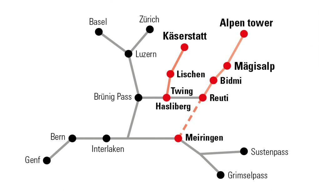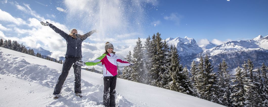
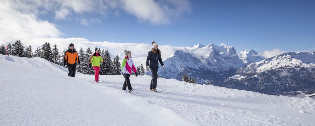
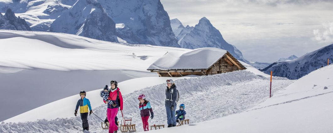
Winter Hiking Hasliberg
Leaving your footprints in fresh snow and listening to the sound of the snow crunching underfoot. Around 25km of prepared winter hiking trails await! The hiking trails are marked with a pink sign – please stick to the prepared trails. Hiking times may vary depending on the
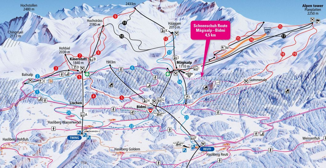
Käserstatt - Mägisalp (Murmeliweg):
The trail begins at the top station of the cable car Twing - Käserstatt. After a short ascent, takes you gradually down to Mägisalp. the hike takes roughly 1 hour an can also be done the other way around.
We recommend you a 2 zones hiking day pass from Hasliberg or a 2+ zones hiking day pass from Meiringen.
Käserstatt - Balisalp - Lischen:
The trail leads from the Käserstatt mountain restaurant down to Balisalp and on to the mid-station at Lischen. The hike takes roughly 1 hour.
The trail leads from the Käserstatt mountain restaurant down to Balisalp and on to the mid-station at Lischen. The hike takes roughly 1 hour.
Start: Mountain station Käserstatt, 1'840m above see level
End: Middel station Lischen, 1'480m above see level
Altitude difference: 360m
Length: approx. 4 km
Duration: approx. 1h
End: Middel station Lischen, 1'480m above see level
Altitude difference: 360m
Length: approx. 4 km
Duration: approx. 1h
We recommend you a 2 zones hiking day pass from Hasliberg or a 2+ zones hiking day pass from Meiringen.
Lischen - Wasserwendi:
From the mid-station at Lischen the trail leads down through the village of Wasserwendi to the bottom station in Hasliberg Twing. The hike takes approximately 45 minutes.
From the mid-station at Lischen the trail leads down through the village of Wasserwendi to the bottom station in Hasliberg Twing. The hike takes approximately 45 minutes.
Start: Middel station Lischen, 1'480m above see level
End: Valley station, 1'161m above see level
Altitude difference: 319m
Length: approx. 2,5 km
Duration: approx. 45 minutes
End: Valley station, 1'161m above see level
Altitude difference: 319m
Length: approx. 2,5 km
Duration: approx. 45 minutes
We recommend a single ride ticket from Hasliberg Twing - Lischen,
Lischen-Bidmi:
An easy, flat path leads from the mid-station at Lischen to the mid-station of the Hasliberg Reuti - Mägisalp aerial cable car at Bidmi. The hike takes approximately 30minutes.
An easy, flat path leads from the mid-station at Lischen to the mid-station of the Hasliberg Reuti - Mägisalp aerial cable car at Bidmi. The hike takes approximately 30minutes.
Start: Middel station Lischen, 1'480m above see level
End: Middel station Bidmi, 1'425m above see level
Altitude difference: 55m
Length: approx. 1,4 km
Duration: approx. 30 minutes
End: Middel station Bidmi, 1'425m above see level
Altitude difference: 55m
Length: approx. 1,4 km
Duration: approx. 30 minutes
We recommend you a 1 zone hiking day pass from Hasliberg or a 1+ zone hiking day pass from Meiringen.
Mägisalp-Bidmi:
The trail from Mägisalp takes you across the Alpbach river, past some alpine huts, down along the road through pine forests and down to the Bidmi Lake. The hike along this hiking an dsledding trail takes approximately 45 minutes.
The trail from Mägisalp takes you across the Alpbach river, past some alpine huts, down along the road through pine forests and down to the Bidmi Lake. The hike along this hiking an dsledding trail takes approximately 45 minutes.
Start: Mountain station Käserstatt, 1'710m above see level
End: Middel station Lischen, 1'423m above see level
Altitude difference: 287m
Length: approx. 3 km
Duration: approx. 45 minutes
End: Middel station Lischen, 1'423m above see level
Altitude difference: 287m
Length: approx. 3 km
Duration: approx. 45 minutes
We recomment you a 2 zones hiking day pass from Hasliberg or a 2+ zones hiking day pass from Meiringen.
Bidmi-Reuti:
The trail starts at Bidmi, mid-station of the cable car Reuti - Mägisalp. After a short ascent along the hiking & skiing path, the trial crosses the ski slope and then leads down along the eastern flank of the Hasliberg to Hasliberg Reuti. The hike takes roughly 1 hour and 40 minutes.
The trail starts at Bidmi, mid-station of the cable car Reuti - Mägisalp. After a short ascent along the hiking & skiing path, the trial crosses the ski slope and then leads down along the eastern flank of the Hasliberg to Hasliberg Reuti. The hike takes roughly 1 hour and 40 minutes.
Start: Middel station Lischen, 1'423m above see level
End: Middel station Lischen, 1'065m above see level
Altitude difference: 358m
Length: approx. 4 km
Duration: approx. 1h 40 minutes
End: Middel station Lischen, 1'065m above see level
Altitude difference: 358m
Length: approx. 4 km
Duration: approx. 1h 40 minutes
We recomment you a single ride ticket form Hasliberg Reuti to Bidmi.
Bidmi - Twing:
The trails follows the road from Bidmi down to the village of Wasserwendi, offering wonderful views of the Lake of Brienz. the hike takes roughly 45 minutes.
The trails follows the road from Bidmi down to the village of Wasserwendi, offering wonderful views of the Lake of Brienz. the hike takes roughly 45 minutes.
Start: Middel station Bidmi, 1'423 m above see level
End: Valley station, 1'161m above see level
Altitude difference: 262m
Length: approx. 2,8 km
Duration: approx. 1h
End: Valley station, 1'161m above see level
Altitude difference: 262m
Length: approx. 2,8 km
Duration: approx. 1h
We recommend you a single ride ticket from Hasliberg Reuti to Bidmi.
Panoramaweg Brünig - Hohfluh - Wasserwendi - Reuti:
This varied trail takes you along the whole length of the Hasliberg, through snow-covered forests and past historic houses and offers you wonderful views of the snow-covered mountains. The whole hike takes roughly 3 hours but there are number of bus stops along the way, shoul you wish to shorten the hike. The trail is maintained by the Hasliberg Council and may be closed at short notice due to heavy snowfall.
This varied trail takes you along the whole length of the Hasliberg, through snow-covered forests and past historic houses and offers you wonderful views of the snow-covered mountains. The whole hike takes roughly 3 hours but there are number of bus stops along the way, shoul you wish to shorten the hike. The trail is maintained by the Hasliberg Council and may be closed at short notice due to heavy snowfall.
General information:
The hikes can be combined to suit your program. Don't miss to visit the Alpen tower.
We recommend sturdy, non-slip winter boots. Information about if the hiking trails are and the lifts are open can be found on our Website.
The hikes can be combined to suit your program. Don't miss to visit the Alpen tower.
We recommend sturdy, non-slip winter boots. Information about if the hiking trails are and the lifts are open can be found on our Website.

Information:
Bergbahnen Meiringen-Hasliberg
Twing 365L
CH-6084 Hasliberg Wasserwendi
Telefon: +41 33 550 50 50
Twing 365L
CH-6084 Hasliberg Wasserwendi
Telefon: +41 33 550 50 50